8 Best Apps Similar To GPX Editor|AppSimilar

Top Grossing Apps: GPX Editor
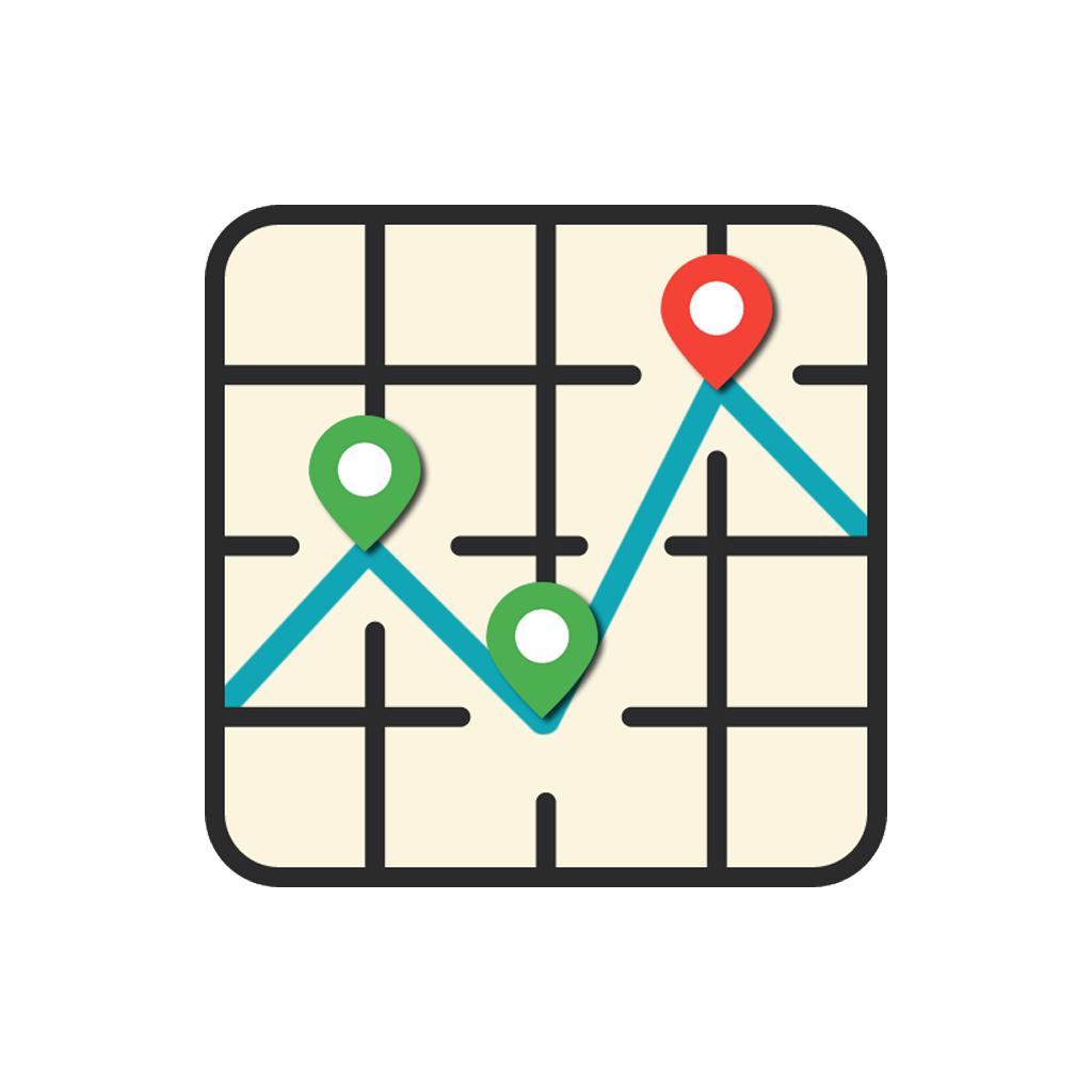
GPX Editor
APP STORE: App Store $0.99
CURRENT VERSION : 1.6(2018-01-10)
APP CATEGORIES : Navigation, Productivity
APP RATINGS & REVIEWS : 0.9 (<5K)
| APP DOWNLOADS | APP REVENUE | DAILY ACTIVE USER OF APP |
| <5K | <5K | <5K |
APP DESCRIPTION
GPX Editor is an app that draw GPS information on map, and export them as .GPX file.
For example, some apps can record everywhere you have been in your whole life, but it will dramatically increase power consumption and decrease battery life while recording, and can’t record the place you have been before using that app. It’s will be a pity in your life.
For this reason, if you have this app, It's not only you can draw the place you have been and export them to GPX files, then import to other apps, but also decrease power consumption to protect your battery.
Feature
- Support export by Dropbox, Message or email.
- Support direct share GPX data to other apps.
APP STORE OPTIMIZATION DETAIL
PLATFORMS : App Store
REPORT
KEYWORD SEARCH
More Other Apps’ Report
Apps Similar To GPX Editor
| Top 8 Similars | More Similar Apps |

Name:OsmAnd Maps Travel & Navigate Price:Free
Description:Note: Continued use of GPS running in the background can dramatically decrease battery life.
OsmAnd Maps is a map application with access to the free, worldwide, and high-quality OpenStreetMap (OSM) data. All map data can be stored on your device's memory card for offline use. All the main functionalities work both online and offline (no internet needed).
Some of the main features:
Map Viewing
• Display your position and orientation on the map
• Optionally align the map according to compass or your direction of motion
• Save your most important places as Favorites
• Display POIs (point of interests) around you
• Can display specialized online tile maps
• Can display satellite view (from Bing)
• Can display different overlays like touring/navigation GPX tracks and additional maps with customizable transparency
• Optionally display place names in English, local, or phonetic spelling
Use OpenStreetMap
• High quality information from the best collaborative projects of the world
• Global maps from OpenStreetMap, available per country or region
• Unlimited download, directly from the app
• Always up-to-date maps (updated at least once a month)
• Compact offline vector maps
• Also supports online or cached tile maps
Safety Features
• Optional automated day/night view switching
• Share your location so that your friends can find you
Bicycle and Pedestrian Features
• The maps include foot, hiking, and bike paths, great for outdoor activities
• Special display modes for bike and pedestrian
• Optional public transport stops (bus, tram, train) including line names
• Optional speed and altitude display
OsmAnd is open source and actively being developed. Everyone can contribute to the application by reporting bugs, improving translations, or coding new features. The project is in a lively state of continuous improvement by all these forms of developer and user interaction. The project progress also relies on financial contributions to fund the development, coding, and testing of new functionalities.
Approximate map coverage and quality:
• Western Europe: ****
• Eastern Europe: ***
• Russia: ***
• North America: ***
• South America: **
• Asia: **
• Japan & Korea: ***
• Middle East: **
• Africa: **
• Antarctica: *
Most countries around the globe available as map downloads!
From Afghanistan to Zimbabwe,from Australia to the USA. Argentina, Brazil, Canada, France, Germany, Mexico, UK, Spain, ...
We offer 4 auto-renewing subscription options named OsmAnd Live for getting all features + hourly map updates in the app:
$1.99 / month
$3.99 / 3 month
$7.99 / 1 year
Payment will be charged to your iTunes Account at confirmation of purchase.
Subscription renews automatically unless canceled at least 24 hours prior to the end of the subscription period.
Account will be charged for subscription renewal at the price of the chosen package within 24-hours before the current period ends.
You can manage subscription and turn off auto-renewal in Account Settings in iTunes after purchase. Once purchased, refunds will not be provided for any unused portion of the term.
If you purchase a subscription during a free trial period, the unused portion of this period will be forfeited.
A link to the terms of use: https://osmand.net/help-online/terms-of-use
A privacy policy link: https://osmand.net/help-online/privacy-policy
If you cannot find the answer to your question, contact us at [email protected]
Rating:4.45 Show Detail

Name:Map My Walk by Under Armour Price:Free
Description:Track and map every walk with MapMyWalk. For every mile you go, you’ll get feedback and stats to help you improve your performance. Discover new workout routes and save or share your favorites, and get inspired to reach new walking goals with a 40 million member strong community of athletes. Whether you’re a beginner on your first long walk or a pro, you’ll find the features and tools you need to stay on track and motivated along the way.
TRACK AND MAP YOUR WORKOUTS
- Get audio feedback on every GPS-tracked walk and view the route you took on the map.
- Choose from over 600 different sports to keep a full log of all your activities.
- Use the Routes feature to find nearby places to walk, save your favorite paths, add new ones and share them with others.
ANALYZE YOUR PERFORMANCE ON EVERY MILE
- Gain in-depth insights on every workout, with detailed stats including pace, distance, duration, calorie burn, elevation, and more.
- Keep an eye on your progress by reviewing your previous workouts.
- Set personal goals and adjust them as you improve with each walk.
CONNECT WITH APPS AND WEARABLES
- Let your shoes do the tracking - SpeedForm® Gemini 2 Record-Equipped Shoes automatically track your activity and sync your data with your MapMyWalk app.
- Sync your data with the hottest apps and wearables, including Garmin, Fitbit, Jawbone, and hundreds more.
- Take control of your nutrition by connecting with MyFitnessPal for a comprehensive look at your calorie intake and burn.
TAKE YOUR WALKS FURTHER WITH MVP PREMIUM FEATURES
- Reach your walking goal with a personal training plan which adapts dynamically to your fitness level as you improve.
- Monitor and analyze your Heart Rate zones to adjust your training based on your goal.
- Keep distractions to your training to a minimum with no ads.
- Create custom splits based on the distance you want to track.
- Access additional premium features on MapMyWalk.com
If you upgrade to a premium MVP subscription, payment will be charged to your iTunes account at confirmation of purchase. The monthly subscription costs USD 5.99 per month, while the yearly subscription costs USD 29.99 per year, or USD 2.50 per month. Your subscription renews automatically unless canceled at least 24 hours prior to the end of the current period. There is no increase in cost when renewing.
Subscriptions can be managed and auto-renewal turned off in Account Settings in iTunes after purchase. Once purchased, the current period cannot be canceled. Any unused portion of a free trial period is forfeited if you choose to purchase a premium subscription to MVP.
Find the full terms and conditions and our privacy policy at https://account.underarmour.com/terms-and-conditions and https://account.underarmour.com/privacy respectively.
Note: Continued use of GPS running in the background can dramatically decrease battery life.
MapMyWalk is powered by Under Armour Connected Fitness – the world’s largest health and fitness community. The complete suite of Under Armour apps, built to empower healthy and active lifestyles, includes UA Record, MapMyFitness, Endomondo, and MyFitnessPal.
Apple Health permissions allow us to track your heart rate accurately, update activity rings, and save your workout data.
Rating:4.7 Show Detail

Name:Skinseed for Minecraft Skins Price:Free
Description:Meet the most versatile Minecraft skin app. Works with both Minecraft Pocket Edition and PC/Mac version.
• Intuitive skin editor with unique features such as intelligent texture generation
• 10,000,000+ high quality, fully searchable skins to be used as it is, or as a starting point for your work
• Wardrobe feature providing customized skins collection
• Interactive 3D previews
• Import from Minecraft game using usernames
• Community where you can share your works with your friends
• One touch, direct export to Minecraft
We are always excited to hear from you! If you have any questions or feedback, please contact us using the contact form provided in the app.
Disclaimer:
This app is not affiliated with, or endorsed by Mojang. "Minecraft" is a trademark of Notch Development AB.
Rating:4.25 Show Detail

Name:Best Area Price:USD 0.00
Description:Our app facilitates field survey and enables you to determine distances and areas on a map.
Fields of application are measuring of floor space, lawn, fencing, asphalt coatings, forest areas, squares, buildings, landscape, flat roofs, etc. At the same time, measuring distances is possible for walking distances or routes covered by bicycle or car.
‚Best Area‘ offers the same functionality as ‚Best Area Pro‘. However, advertising will be displayed and the number of places is limited to nine.
Our app offers the following features:
- Measuring distances and areas
- Several option for entering locations
- Navigation function
- Automatic recognition of areas
- GPX import/export
- Switching between metrical and imperial measuring system
- Support of diverse maps
Entering locations:
- Directly from point in map
- Typing in address with automatic recognition
- Location of photo
- From existing area
Possible navigations:
- Apple Maps
- Google Maps
- Navigon
- Waze
- TomTom
Rating:0 Show Detail
Name:GPS-Trk 3 Price:¥0
Description:Professional-grade, new generation GPS system that works in both Stand-Alone Mode and Network Mode.
[Trusted name in smartphone GPS app since 2009. For both iPhone and iPad. Subscription is required for app use.]
1) Stand-Alone Mode (smartphone only)
In this mode, GPS-Trk works as traditional professional-grade GPS app.
• Full functionalities packed into clean easy-to-use UI.
• Reliability (several days of continuous measurement).
• Scalability (very long track like around the earth).
• Store all past tracks of several years on smartphone. Effectively, you never have to delete tracks to save space.
• Minimal usage of battery, network data and disk storage.
• Track with photos.
• Import / export track file in KML, KMZ, eKML, eKMZ, GPX format (with photo for KMZ, eKMZ) via email attachment, Dropbox.
• Apple Maps, Google Maps, OpenStreetMap (Offline map for OpenStreetMap)
• Track measurement works even without network (Cellphone, Wi-Fi).
• Track measurement by time or by distance.
• Track animation.
• Single app supports both iPhone and iPad. (screen optimized differently.)
2) Network Mode (smartphone + GPS-Trk Net)
The easiest way to share your GPS track path (with photos) with friends in real-time!
[Check it out at https://gpstrk.hc-eng.com]
During adventures (climbing, biking, airplane, ship) or business (fleet management), your friends, support team can watch your movement.
The user records track (movement, photos) with GPS-Trk app on smartphone. The other persons can watch the track moves remotely in real-time with any web browser (smartphones, PCs).
Free - create public tracks. (for Hobby. Show it to the world!)
Subscription - create shared or private tracks. (for Business)
You carry smartphone and friends watch your movement with Web browsers.
or
You put smartphone on target (scientific research, car, kid, pet etc.) and you monitor its movement with Web browsers.
[Continued use of GPS running in the background can dramatically decrease battery life.
Payment will be charged to your Apple ID account at the confirmation of purchase. Subscription automatically renews unless it is canceled at least 24 hours before the end of the current period. Your account will be charged for renewal within 24 hours prior to the end of the current period. You can manage and cancel your subscriptions by going to your account settings on the App Store after purchase.
Terms and Conditions: https://hc-eng.com/terms-and-conditions/
Privacy Policy: https://hc-eng.com/privacy-policy
]
Rating:1.35 Show Detail

Name:Driving Zone 2 Lite Price:Free
Description:Driving Zone 2 Lite is a racing simulator with realistic car physics, stunning graphics and innovative gameplay.
You can choose from a huge range of cars, from urban hatchbacks, to luxury business sedans and powerful sports cars designed for racing. Great opportunities of tuning allow you to modify any of your cars visually and technically. All cars have detailed body and interior with a dashboard, that is illuminated at night, this creates the effect of full presence and realism.
Earn points by making dangerous overtakes at high speed, but beware of the police, which will chase you for the accident, running a red light and speeding. Driving Zone 2 Lite is a racing game for fans of extreme driving.
DRIVE WITHOUT LIMITS
You have an open game world with dangerous turns and hills, and also unpredictable intersections. Drive in any direction during the day and at night, through the city streets and country roads with their impressive landscapes. Be careful on the winter road with its snow-capped roadsides, going on it it will lead to drifts and slips. Road traffic lives its own life and adheres the rules of the road. With experience of driving, you can increase the density of traffic, in order to increase the difficulty of the game.
EXTENDED TUNING SYSTEM
In the simulator of street racing Driving Zone 2 Lite engine sound of vehicles, and also their technical characteristics correspond to real ones. Use the tuning system to improve the technical specifications of your cars. For example, buying engine upgrades will give you a speed boost, the setting of sport transmission will open the drive selection option, buying the advanced suspension, you will be able to modify the ground clearance and wheel camber, the installation of nitro allows you to reach the maximum speed.
CREATE YOUR UNIQUE STYLE
You can improve the exterior of your car. The game contains a huge range of settings for changing both external and internal elements of the car. Disks, spoilers, air intakes, neon light on the bottom, steering wheel and even headlights, all this and much more can be modified according to your taste. Create your own unique car and show it to the world using photo mode.
Rating:3.9 Show Detail

Name:Fitmeter Bike - GPS Cycling Price:$4.99
Description:Fitmeter Bike convierte tu iPhone o iPad en un ciclocomputador con una increíble gama de funciones. Tu sesión se monitoriza mediante GPS y todos los datos se presentan en tiempo real. La aplicación está diseñada para una amplia variedad de usuarios, desde principiantes hasta profesionales.
Características:
- La ruta y el posicionamiento GPS de la sesión se muestran en un mapa con marcadores de distancia
- Velocidad actual
- Distancia
- Duración de la sesión
- Tiempo de parada
- Detección automática de paradas
- Velocidad media
- Velocidad máxima
- Monitorización de altitud. Subida y bajada
- Calorías quemadas
- Apple Watch. Monitoree y controle su actividad usando su Apple Watch
- Medición de frecuencia cardíaca. Use su Apple Watch o un sensor Bluetooth externo
- Sensor de ritmo y velocidad
- Pulso medio
- Tiempos parciales
- Historial. Todas las actividades se almacenan y se pueden consultar. No hay límite de cantidad de sesiones
- Exportar todas las actividades a un archivo CSV
- Estadísticas por sesión. Velocidad y altitud sobre distancia
- Estadísticas de las 10 últimas sesiones
- Récords. Consulta todos tus records y un resumen de todas las sesiones
- Compatibilidad con Facebook. Publica tus sesiones en tu muro de Facebook
- Compatibilidad con Apple Salud: Distancia en bicicleta, Energía en actividad, Entrenos, Peso
- Sin publicidad
- No se requiere registro
- Sin anuncio por correo electrónico
El uso continuo del GPS en segundo plano puede reducir considerablemente la duración de la batería.
Rating:3.7 Show Detail

Name:World War Rising Price:Free
Description:What will history decide about you? Prove your worth and lead epic armies of the most lethal troops, vehicles, and aircraft from WWI to the modern era!
Command iconic troops as you develop your army toward glory! Join an alliance to collectively crush your enemies or stay independent and farm resources to build an epic stronghold. Play your own style in this expansive world of historical war!
- A truly global game with millions playing around the world
- Make alliances with those you trust and rivalries with those you don't!
- Build a base that evolves through a century of combat technology
- Battle world map enemies and collect components to build colossal weapons
- Equip your commander with armor and weapons and unleash them on your enemies as they lead your troops
- Use vehicles from the last century of war, from WWI tanks to Apache helicopters!
- Command 4 military tiers consisting of 16 troop types
How will you play? Forge an unbeatable alliance with others who share your strategy or risk it all as a military lone wolf! It's your base, your rules in this fun MMORPG builder and strategy game!
Privacy Policy: http://www.worldwarrising.com/privacy-policy
Terms of Service: http://www.worldwarrising.com/terms-of-use
Game Page: http://worldwarrising.com
Rating:3.95 Show Detail